
Mytholmroyd Trail
- Paul Clarke
- May 30
- 5 min read

Mytholmroyd is the only village in Calderdale with its own railway station, although a sign close to the station directs visitors towards the “town centre”! The village’s distinctive name means “ a clearing for settlement, where two rivers meet”, and the village has existed since at least the thirteenth century, when it was recorded as Mithomrode. Finds from the Bronze and Iron Ages have been found in the area, as has a hoard of Roman coins. The village was once home to a now-demolished mill, and the Rochdale Canal passes through it. Today, it is predominantly a commuter village, although it has suffered several disastrous floods that have prompted the development of flood alleviation schemes along the Calder and its tributary the Cragg Brook. Despite its modest size, it has plenty of historical interest to see; in addition to the canal, it has more than twenty-one listed buildings, several of them on the walk.
Mytholmroyd Railway Station opened on the Manchester and Leeds Railway in 1847, seven years after the line opened; the original station house (located by the bridge that carries the railway track over New Road) is currently disused. From platform 1, we leave the station and walk down the path to New Road. We then turn left and follow the road under the railway bridge, continuing straight ahead until it reaches Mytholmroyd Bridge, which carries the road over the River Calder. Take a detour to the right here to visit the Church of St. Michael, a Grade II-listed building dating from 1848 and built in the early English style.

The Church of St. Michael.
After visiting the church, cross the Grade II-listed bridge to reach Burnley Road. The bridge dates from 1684 and was widened in 1823, but a bridge has been recorded on the site since 1329. The striking village War Memorial, topped by a white marble statue of a solider, can be seen directly opposite, on the other side of the road.
From here, we turn left and follow the road past the Dusty Miller public house, which along with its attached barn is Grade II-listed and dates from the late eighteenth century. We then turn left over the next bridge across the river (not listed, and a rather utilitarian modern road bridge), following Caldene Avenue, which immediately bends to the right. Continue along the avenue, then turn left into Paddy Bridge Road, and when this bends left just after crossing a bridge over the railway line, continue straight ahead and follow a footpath next to Stubb Fields, until it ends at Park Lane. The next section of the walk becomes increasingly rural, as we leave the village and head out into the surrounding countryside. And so we turn right and follow Park Lane for approximately two-thirds of a mile, as it becomes a track running between fields, soon becoming Wood Hey Lane. This section of the walk provides pleasant views down towards the Calder and the Rochdale Canal in the bottom of the valley on the right. When the lane ends at a junction, turn right along Carr Lane, then take the next right turn, still on Carr Lane, which now becomes a footpath running downhill between fields, with a wood shortly appearing on the left. It then passes between houses and crosses a bridge over the railway track to end at Burnley Road.
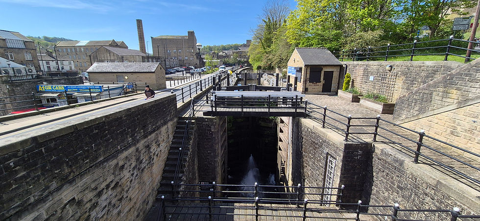
We now cross the road, bear left, and then turn right to gain the towpath of the Rochdale Canal, close to where Falling Royd Bridge No. 14 carries Burnley Road over the cut. Follow the towpath past a winding hole, soon reaching Broadbottom Lock No. 7, where to the right a cast iron sculpture called the Hawk can be seen between the towpath and the road. This was made for the Rochdale Canal by artist Kenny Hunter in 2013 and was inspired by the poem “Hawk Roosting” by former Poet Laureate Ted Hughes, who was born in Mytholmroyd (storyboards based on his celebrated novel The Iron Man can also be seen on the platforms of Mytholmroyd Railway Station). Follow the canal as it next reaches Broad Bottom Bridge No. 13, then on reaching the next bridge (Red Acre Bridge No. 12), leave the towpath and follow Westfield Terrace over the bridge.
From the bridge, continue straight ahead for a short distance, then turn right and climb a stepped path next to a house uphill to a junction. Turn right and follow a stepped path uphill through trees to reach the end of Royd View, and continue along this until it ends at Banksfield Road. Proceed in the same direction, following a path past buildings on the right, and when the path joins the end of Sunny Bank, follow this until it shortly ends at Midgley Road and turn right. On the right are the former Mount Pleasant Mills, now home to Walkley Clogs, also known as the Mytholmroyd Clog Factory and open Tuesday to Saturday for anyone who wants to briefly interrupt the walk to buy some clogs! Some of the mill buildings, which date from the late eighteenth century, are Grade II-listed. Continue along the road, then immediately after it crosses the canal via White Lee Bridge No. 11, turn left to regain the towpath. A little further along the towpath, the former (and currently derelict) White Lion public house can be seen.
Follow the canal as it passes under Halifax Road Bridge No. 10, next reaching Brearley Upper Bridge No. 9, which has lacked a towpath since Moderna Way was widened some years ago . Follow the path up to the road, cross this, and regain the towpath on the other side, continuing to Brearley Bridge No. 8. Just after passing through this, we turn right and part company with the Rochdale Canal via a short path between houses to reach Brearley Lane. We will of course revisit the canal again during the next two walks. Follow Brearley Lane as it bends right and crosses the Grade II-listed Brearley Bridge (built in the late eighteenth century) over the River Calder. Stay on Brearley Road as it becomes a track and runs up hill, bearing right along Hob Lane at a fork (the left turn is private). Follow this uphill, looking left across a field for a view of Sunderland House. This large and striking Grade II-listed house was originally built as a mill-owners house in 1811.
Now back out in the countryside around Mytholmroyd, the walk becomes rural once again. When Hob Lane ends at Little Scout Farm, proceed straight ahead through a wooden gate to follow a stepped public footpath along the edge of a field. Follow the path uphill across another field to reach Scout Road, then turn right and immediately left along a public footpath running uphill along another field edge. At the top of the field, turn right over a stone stile and follow another path along two more fields until it reaches Scout Rock Trail. Bear left and follow this along the top of Scout Rock, a rock face formed by quarrying Hathershelf Scout. There are panoramic views of Mytholmroyd and the Calder Valley below along this whole stretch of the walk. On reaching a wooden stile, climb over this, then bear left (still on Scout Rock Trail), then take the next right turn and follow a cobbled path downhill, ignoring any turn offs as it gradually becomes a tarmacked lane and eventually ends at Hall Bank Lane.

View of Mytholmroyd from Scout Rock.
Turn left and follow Hall Bank Lane, which runs downhill, eventually bending right and ending at Scout Road. Turn left again and follow this until it ends at a junction, taking a short detour to the left to see a stone drinking fountain by the side of the road. Turn right and follow New Road past the Shoulder of Mutton pub on the left. Finally, turn right to return to the railway station.
From the railway station it is back onto the train for a ride further along the Calder Valley Line, but one that barely allows time to sit down. Just three minutes away, the our next stop is the town of Hebden Bridge.


Comments